The historic snow accumulation total has taken a toll on more than just the patience of Boston residents. It’s had a substantial affect on infrastructure and how people commute, but the city’s recent partnership with Waze has allowed for a City Hall to explore data driven solutions to the most frustrating of problems.
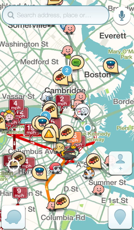
Aside from pumping Bostonians full of free caffeine with Dunkin Donuts, Waze aggregates traffic data from more than 440,000 Greater Boston Area users in real-time and displays if there’s congestion, an accident, or other roadside deterrent people behind the wheel may be experiencing.
“The Waze partnership is really interesting for us because we’re able to track in real time, now, how traffic is in various parts of the city like never before,” said Dan Koh, Mayor Marty Walsh’s chief of staff. “This gives us quantifiable data – we can literally see if the average speed is 15 mph or 14 mph.”
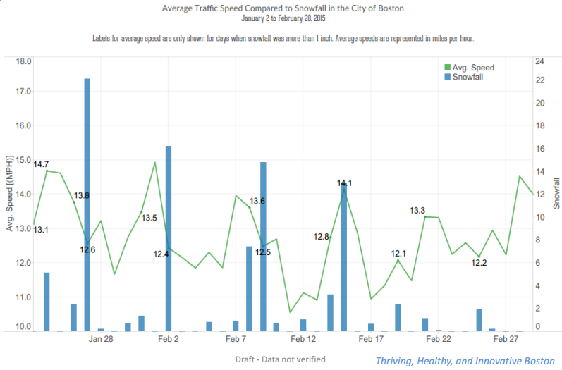
For example, in a cabinet meeting Friday morning, Waze data compiled by the Department of Innovation and Technology and Boston Transportation Department – represented by Chief Information Officer Jascha Franklin-Hodge and BTD Commissioner Gina Fiandaca – illustrated average driving speeds during time of snowfall totaling more than one inch.
The data was just from Washington Street between Jan. 22 and Feb. 28, but it generally showed that speeds decrease when the volume of snowfall increases.
Sure, it sounds like common sense. But now that the city has this type of information in hand, they’re able to work out how to best streamline traffic during times of inclement weather as well as put out a call to the public to do the same.
Franklin-Hodge said that the upcoming HubHacks hackathon on March 14 will feature these kinds of driving statistics, giving participants the opportunity to devise next-generation fixes to problems that plague innumerable residents.
“Instead of going through some massive, longterm, expensive traffic study we can actually run a test,” said Franklin-Hodge. “We have this real-time data source that lets us measure the impact of that test and quickly decide: is something we want to scale up, is this something that doesn’t work or does this point us in a new direction for how to better manage traffic.”
Koh used the example of a fictional pilot program on Commonwealth Avenue.
“Anyone who drives down [Commonwealth Ave.] knows that people double-park all the time,” he posited. “Do we do a pilot test where we enforce the violation of double parking more, and we can measure how it affects traffic?”
In essence Waze provides the City of Boston with additional dexterity and a new vantage point for viewing how the city operates on a street and residential level.


