A coalition of agencies working on behalf of the Innovation District released a comprehensive and sustainable transportation plan for the South Boston waterfront.
The plan aims to support the expansion of Massachusetts’ fastest growing urban area by upgrading transportation infrastructure and providing system updates over the next 20 years. It was published by the Massachusetts Convention Center Authority, Massport, MassDOT and the City of Boston; the conglomeration was managed by A Better City.
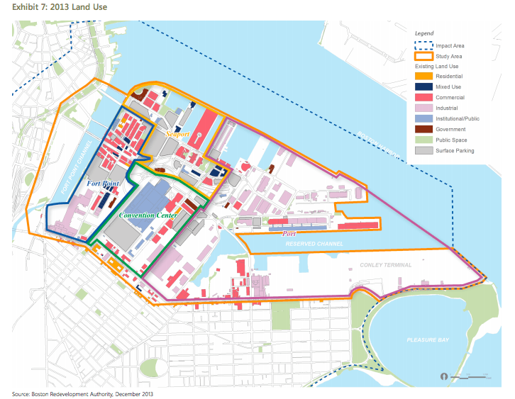
“Over the next two decades, another 17 million square feet of development is underway or planned,” the report reads, “including 5,300 new residences, 6 million square feet of new office and research space, nearly one million square feet of port and maritime-related uses, and more than a doubling of convention and hospitality space.”
To accommodate this breakneck growth, the agencies engaged in a 12-month planning process solicited the public for community input, and devised strategies and goals for improving multimodal access to the Innovation District and its economic drivers.
The Port of Boston, after all, saw 3.4 million tourists visit the waterfront in 2013. On top of that, the Port supports roughly 50,000 jobs from 1,600 different companies.
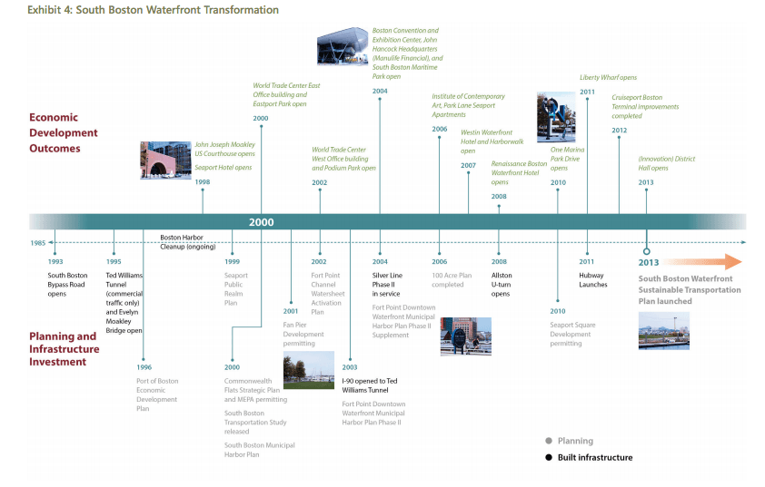
Currently, access to the waterfront is obtainable via the Silver Line public transit route, water taxi, car (although there is a lack of connecting roadways to the city proper), foot and bike. The waterfront is home to three Hubway stations (though they’re closed for the winter) as well as two more down by the dry dock.

“The MBTA will continue to support efforts to improve access and mobility throughout the South Boston Waterfront,” said MBTA spokesperson Joe Pesaturo (the MBTA oversees Silver Line operations). “The next steps involve soliciting public feedback on the plan.”
The transportation plan expects a stark increase in all of those modes of transportation over the next two decades. By 2035, per the report, trips taken within the waterfront are expected to triple and comprise 26 percent of all trips taken in, to and from the area.
To that end, the agencies have suggested Silver Line operations and capacity be overhauled and connections to South Station expanded, more ferry service to the direct waterfront added, and access to downtown as well as I-93 and I-90 improved.
For cyclists and pedestrians, public safety infrastructure is paramount. Sidewalk connections, a hospitable walking environment, connected bike networks and more Hubway bikeshare stations could bolster safety measures and temper any worries.
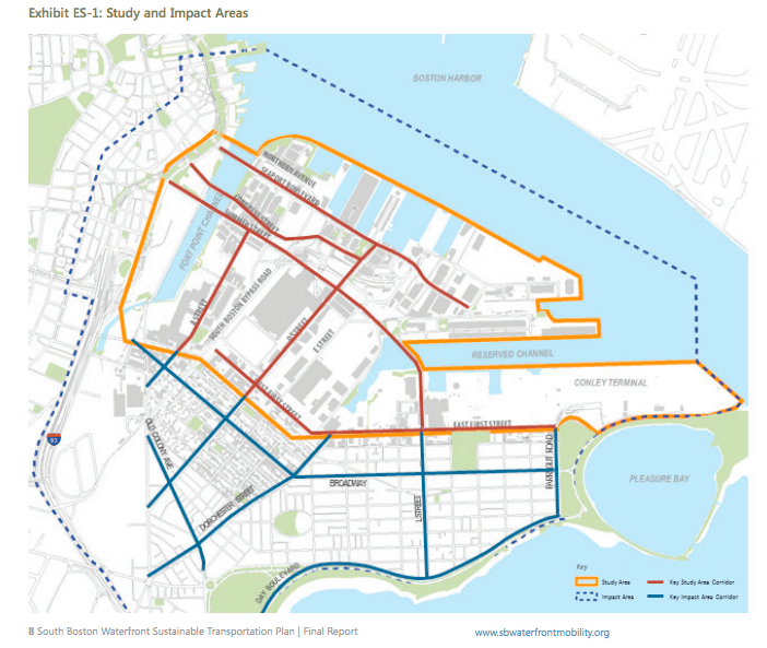
More specifically, this would be done in the form of streetscape and circulation enhancements on Northern Ave. and East Service Road, which the report boasts includes new north-south connecting streets.
The Northern Ave. footbridge, known colloquially as the Fort Point Channel Bridge, is currently closed for all usage indefinitely. For foot and bike traffic to flow swimmingly, and safely, its repair ought to be undertaken swiftly.
“Among all the recommendations, my priorities would be on enhanced public transit services and improving the pedestrian experience in the Waterfront,” Jim Rooney, executive director of the MCCA, told BostInno. “The input we received during the study indicate that this is what most people want.”
Most recently, the Mayor’s Office of New Urban Mechanics altered the allotted maximum time people can park at certain metered spots in the Innovation District. Because such a substantial amount of traffic is derived from people trying to find parking, City Hall examined where this congestion happens the most and the least, and analyzed the data to determine best practices moving forward.
All of the upgrades and innovations laid out by the coalition sound fantastic. The question that remains, however, if the city and state find it pertinent to move forward with any of the suggestions, is how everything will be paid for.

The agencies state in the report they’ll advocate for public-private partnerships for funding.
MassDOT Acting Secretary and CEO Frank DePaola hopes the report will catalyze fundraising.
“The plan was created to set transportation funding priorities and improve how people move in, out, and within the South Boston Waterfront,” DePaola told BostInno in an email. “Residents, businesses, industries, and other stakeholders are also very much a part of this process. This plan is not a static document.”
DePaola contends that certain aspects of the plan can be acted on immediately and even implemented within the next six months – things like signal improvements on the Silver Line and street-level access to more frequently trafficked highways. As Pesaturo notes as well, continued input and involvement from the public as well as local stakeholders will be critical for how best to go about the larger-scale changes.
On Beacon Hill, state Senator Linda Dorcena Forry, whose district includes the waterfront, will be filing HD3545, “An Act establishing a special commission on transportation in the city of Boston,” during the legislative session to create a governing body for the the plan. BostInno reached out to Sen. Dorcena Forry’s office to get more specifics for the bill, but they were not immediately available for viewing.
And with a potential 2024 Summer Olympic bid looming two years off the horizon, it’ll be interesting to see if the waterfront will be a regional leader in making the kinds of infrastructure refurbishments needed to handle a spectacle of the Games’ caliber and the temporary population swell that comes with it.

